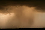
Work work work. No time for anything else. Couldn't even get out this last couple days, which just about killed me on Wednesday.
Oh well. Can't get to them all. Next week looks active and I will have time, so here's to hoping for a chase or two in the near future.
Friday, June 19, 2009


Saturday, June 6, 2009
June 7 forecast- and RAIN
Sitting here listening to the lovely patter of raindrops on the roof. Up north here we missed out on the heavier stuff, but the ground is actually wet for the first time in weeks. I wish it would do this for the next week...
Tomorrow is a day I sure wish I could get out. Looking explosive down in southeast Nebraska and southwest Iowa. Finally a day with good moisture, good instability, plenty of upper support. Family comes first, so I will be armchairing again. Definitely the best set up of the year within shouting distance of our area, and the bonus might be the copious rain it sends our way.
Hearty congratulations to all the folks who scored last night, it sure was fun to watch. Yeah, I wished I was there, but it still is satisfying in a way to see all you guys come up big. Ma Nature finally put on a real show for everyone. It was really nice to see the V2 crew score big as well. They've waited long enough. The live footage was hands down the most incredible thing I have ever seen. If you didn't catch it, it's all over youtube. The shot down the vortex as the funnel tilted towards the camera was absolutely incredible. No other words for it. Amazing.
Tomorrow is a day I sure wish I could get out. Looking explosive down in southeast Nebraska and southwest Iowa. Finally a day with good moisture, good instability, plenty of upper support. Family comes first, so I will be armchairing again. Definitely the best set up of the year within shouting distance of our area, and the bonus might be the copious rain it sends our way.
Hearty congratulations to all the folks who scored last night, it sure was fun to watch. Yeah, I wished I was there, but it still is satisfying in a way to see all you guys come up big. Ma Nature finally put on a real show for everyone. It was really nice to see the V2 crew score big as well. They've waited long enough. The live footage was hands down the most incredible thing I have ever seen. If you didn't catch it, it's all over youtube. The shot down the vortex as the funnel tilted towards the camera was absolutely incredible. No other words for it. Amazing.
Thursday, June 4, 2009
Wouldn't this be nice?

Yeah, that's the GFS 96 hour accumulated precip by about next Wednesday. I certainly hope for once that this isn't overdone. We need rain any way we can get it, fast, slow, whatever.
If I were chasing the next 3 days, I would park in Colorado and stay there. Nothing seems a sure thing this weekend but after watching radar and live streams tonight, I would say Colorado would be a sure bet for the next couple days for some nice stuff. Probably would be alone in a sea of LPs. I've always wanted to chase out in eastern Colorado.
Looks really inactive around here for a while, which is fine because I blew some of my chase funds on stupid chases the last couple weeks and there's a family to feed and work to be done... looks like I'm back to radar/stream watching for a while.
One small edit: If tonight's NAM verifies, wow for Saturday night in southeast Nebraska...
Monday, June 1, 2009


Yesterday's "chase" and a bit on Common Sense
Mom and Dad raised me right. Believe it or not, they taught me to respect my elders, listen to those with experience, weigh good advice and make sound decisions.
Some how this year I've thrown all that out the window when it comes to looking for good storms up here. Yesterday I could have listened to the guys I respect, telling us to quit wishcasting, that moisture just doesn't magically appear. I knew in my heart that models usually over do moisture, and it looked terrible to begin with, but wouldn't you know it, I threw all that out the window and drove 4 hours to see junk again. Threw a beautiful afternoon away, when I could have spent it at home, grilling, sitting around and maybe later practicing some lightning photography.
Well guys, you know who you are, you tried to reason with me, but I'm too inexperienced and bullheaded to listen. I'm listening next time.
The cure for SDS is definitely NOT looking at junk.
I'll get some pics up on here soon from yesterday. Got some nice shots that made me wish I were a better photographer and had better equipment, but still nothing that made the drive worth it. Oh yeah, I also got into South Dakota, which, believe it or not, is a first for me. I know, lived here for 39 years, and never been to South Dakota. I wasn't really missing anything I guess.
Some how this year I've thrown all that out the window when it comes to looking for good storms up here. Yesterday I could have listened to the guys I respect, telling us to quit wishcasting, that moisture just doesn't magically appear. I knew in my heart that models usually over do moisture, and it looked terrible to begin with, but wouldn't you know it, I threw all that out the window and drove 4 hours to see junk again. Threw a beautiful afternoon away, when I could have spent it at home, grilling, sitting around and maybe later practicing some lightning photography.
Well guys, you know who you are, you tried to reason with me, but I'm too inexperienced and bullheaded to listen. I'm listening next time.
The cure for SDS is definitely NOT looking at junk.
I'll get some pics up on here soon from yesterday. Got some nice shots that made me wish I were a better photographer and had better equipment, but still nothing that made the drive worth it. Oh yeah, I also got into South Dakota, which, believe it or not, is a first for me. I know, lived here for 39 years, and never been to South Dakota. I wasn't really missing anything I guess.
Saturday, May 30, 2009
Sunday's chase
Well the models keep slowing things down and overdoing moisture as usual. I'm thinking about meandering out west Sunday afternoon and be near Watertown, SD around 4 pm. Not going to try too hard on this one. I would just like to enjoy the day with my wife, stop and eat, take some scenery shots, etc. I think storms might be a little more isolated than expected, at least in the first few hours, which is fine with me, just hoping I'll be in position to get on a good one early.
I suspect SPC will move the slight a little west in the next outlook. Can't see this being more than a 5% tornado day though. But what do I know.
Another tempting target is extreme SE South Dakota all the way down the Nebraska/Iowa state line, but the cap looks stronger down there and upper level wind support is really suspect. Low level hodographs are a lot nicer looking in this area. I have a feeling this is where TVN will be, and it's tempting, but it's a long drive and I'm limited on time because of family/church commitments Sunday morning.
If I could find a nice, isolated, photogenic, elevated supercell I would be completely happy.
I suspect SPC will move the slight a little west in the next outlook. Can't see this being more than a 5% tornado day though. But what do I know.
Another tempting target is extreme SE South Dakota all the way down the Nebraska/Iowa state line, but the cap looks stronger down there and upper level wind support is really suspect. Low level hodographs are a lot nicer looking in this area. I have a feeling this is where TVN will be, and it's tempting, but it's a long drive and I'm limited on time because of family/church commitments Sunday morning.
If I could find a nice, isolated, photogenic, elevated supercell I would be completely happy.
Thursday, May 28, 2009
Hope springs eternal
If I were a chasecation type guy, I'd be thinking long and hard about next week. Wow at the potential. 3000 joules of cape all over the map, nice southwest flow towards the end of the week, good moisture, temps high enough to break the cap, crazy warm front draped across the center of the country all week... I wonder if June is going to try and make up for May.
Sunday looks like a real chase day for us here in MN. There's enough interesting features on the models to perk my ears up for Sunday night. Hints of a shortwave rippling down the warm front in southern MN at just the right time, enough suggestion of backing winds that it has my attention. The cap is worrisome, but there is hope. Looks at least like the cold front will light up, and if that's all we have, I won't mind it all all. Not one single decent event this year, so I'm chomping at the bit.
I'm still a terrible forecaster, but I think we finally have a decent chaseable setup. Time to make sure the gear is working...
Sunday looks like a real chase day for us here in MN. There's enough interesting features on the models to perk my ears up for Sunday night. Hints of a shortwave rippling down the warm front in southern MN at just the right time, enough suggestion of backing winds that it has my attention. The cap is worrisome, but there is hope. Looks at least like the cold front will light up, and if that's all we have, I won't mind it all all. Not one single decent event this year, so I'm chomping at the bit.
I'm still a terrible forecaster, but I think we finally have a decent chaseable setup. Time to make sure the gear is working...
Subscribe to:
Posts (Atom)